
Budenec topographic map
Interactive map
Click on the map to display elevation.
About this map
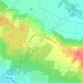
Name: Budenec topographic map, elevation, terrain.
Location: Budenec, City of Zagreb, Croatia (45.82301 16.16366 45.84490 16.19202)
Average elevation: 134 m
Minimum elevation: 109 m
Maximum elevation: 172 m
Other topographic maps
Click on a map to view its topography, its elevation and its terrain.