
Faryab Province topographic map
Interactive map
Click on the map to display elevation.
About this map
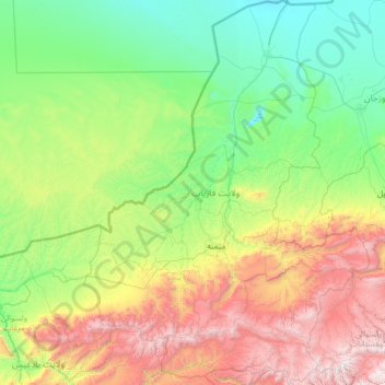
Name: Faryab Province topographic map, elevation, terrain.
Location: Faryab Province, Afghanistan (35.16297 63.88899 37.25099 65.81296)
Average elevation: 1,036 m
Minimum elevation: 256 m
Maximum elevation: 3,702 m
Other topographic maps
Click on a map to view its topography, its elevation and its terrain.
Kohistan
Kohistan, Faryab Province, Afghanistan
Average elevation: 2,269 m