
孔目江国家湿地公园 topographic map
Interactive map
Click on the map to display elevation.
About this map
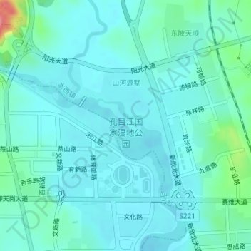
Name: 孔目江国家湿地公园 topographic map, elevation, terrain.
Location: 孔目江国家湿地公园, 城北街道, 水西镇, 渝水区, 新余市, 江西省, 中国 (27.83863 114.92069 27.85407 114.94106)
Average elevation: 58 m
Minimum elevation: 42 m
Maximum elevation: 139 m