
Thank you for supporting this site ❤️
Make a donation
Make a donation
Gear up for your next adventure:
As an Amazon Associate, this site earns from qualifying purchases at no extra cost to you.
Ayamachay topographic map
Click on the map to display elevation.
Thank you for supporting this site ❤️
Make a donation
Make a donation
Gear up for your next adventure:
As an Amazon Associate, this site earns from qualifying purchases at no extra cost to you.
About this map
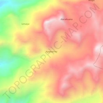
Name: Ayamachay topographic map, elevation, terrain.
Location: Ayamachay, Pachaconas, Antabamba, Apurímac, Perú (-14.23885 -72.93880 -14.19885 -72.89880)
Average elevation: 4,413 m
Minimum elevation: 3,776 m
Maximum elevation: 4,810 m
Thank you for supporting this site ❤️
Make a donation
Make a donation
Gear up for your next adventure:
As an Amazon Associate, this site earns from qualifying purchases at no extra cost to you.