
Bereldange topographic map
Interactive map
Click on the map to display elevation.
About this map
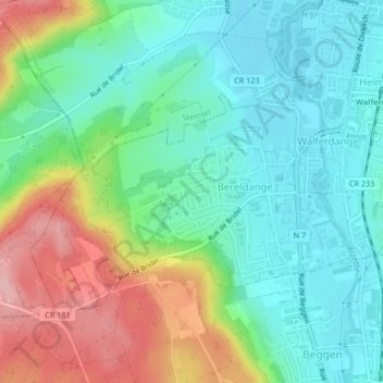
Name: Bereldange topographic map, elevation, terrain.
Location: Bereldange, Walferdange, Canton Luxembourg, Luxembourg (49.64627 6.09814 49.66347 6.13345)
Average elevation: 280 m
Minimum elevation: 226 m
Maximum elevation: 390 m