
Chitré topographic map
Interactive map
Click on the map to display elevation.
About this map
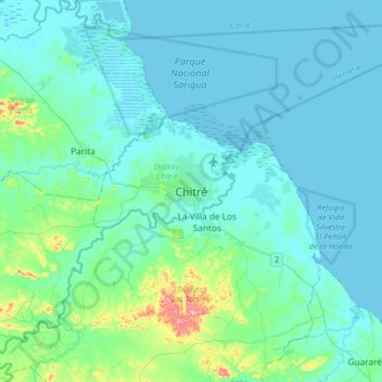
Name: Chitré topographic map, elevation, terrain.
Location: Chitré, Distrito de Chitré, Herrera, 6040, Panamá (7.80331 -80.58835 8.12331 -80.26835)
Average elevation: 28 m
Minimum elevation: 0 m
Maximum elevation: 239 m