Geolocate

Pothupara topographic map

Click on the map to display elevation.

About this map

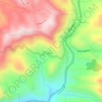
Name: Pothupara topographic map, elevation, terrain.

Location: Pothupara, Ellakkal, Devikulam, Idukki District, Kerala, India (9.97854 77.05397 10.00389 77.06446)

Average elevation: 769 m

Minimum elevation: 549 m

Maximum elevation: 966 m

Gear up for your next adventure:

🔭Compact Hiking Binoculars - Lightweight optics for scouting terrain and spotting wildlife
🔦Waterproof LED Headlamps - Hands-free lighting for evening treks and emergency navigation
📷Camera Straps - Secure straps for carrying cameras while walking
🧤Waterproof Overmitts - Extreme weather protection for hikers and mountaineers
📻Hand-Crank Emergency Radios - Stay updated on weather warnings in remote areas

As an Amazon Associate, this site earns from qualifying purchases at no extra cost to you.