
Wolfgang topographic map
Interactive map
Click on the map to display elevation.
About this map
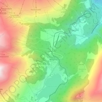
Name: Wolfgang topographic map, elevation, terrain.
Location: Wolfgang, Davos, Prättigau/Davos, Graubünden, 7265, Schweiz (46.81369 9.83362 46.85369 9.87362)
Average elevation: 1,840 m
Minimum elevation: 1,330 m
Maximum elevation: 2,494 m