
Le Bousquet topographic map
Interactive map
Click on the map to display elevation.
About this map
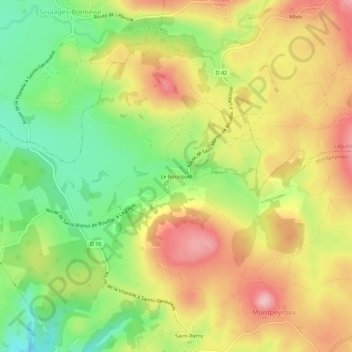
Name: Le Bousquet topographic map, elevation, terrain.
Average elevation: 900 m
Minimum elevation: 798 m
Maximum elevation: 1,002 m
Other topographic maps
Click on a map to view its topography, its elevation and its terrain.
Montpeyroux
France > Occitanie > Aveyron > Montpeyroux
Montpeyroux, Rodez, Aveyron, Occitanie, France métropolitaine, 12210, France
Average elevation: 893 m