Geolocate

Kush topographic map

Click on the map to display elevation.

About this map

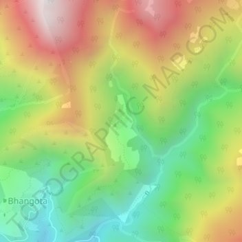
Name: Kush topographic map, elevation, terrain.

Location: Kush, Tharali, Chamoli district, Uttarakhand, India (30.19104 79.39122 30.19255 79.39303)

Average elevation: 1,897 m

Minimum elevation: 1,351 m

Maximum elevation: 2,566 m

Gear up for your next adventure:

🔪Outdoor Multi-Tools - Versatile tools for gear repairs and food prep in the wild
🎒Backpack Rain Covers - Universal waterproof covers to protect your gear from downpours
🥾Walking Shoes - Lightweight walking shoes for countryside and coastal paths
🧼Technical Clothing Wash - Special soap to clean and restore waterproof membranes
👟Women's Trail Running Shoes - Agile footwear for fell running and technical trails

As an Amazon Associate, this site earns from qualifying purchases at no extra cost to you.