
Târgu Secuiesc topographic map
Interactive map
Click on the map to display elevation.
About this map
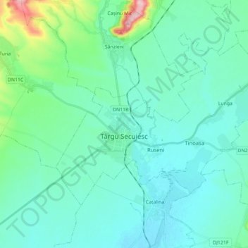
Name: Târgu Secuiesc topographic map, elevation, terrain.
Location: Târgu Secuiesc, Covasna, Romania (45.96676 26.08888 46.04640 26.26333)
Average elevation: 574 m
Minimum elevation: 543 m
Maximum elevation: 746 m
Other topographic maps
Click on a map to view its topography, its elevation and its terrain.