
Sfântu Gheorghe topographic map
Interactive map
Click on the map to display elevation.
About this map
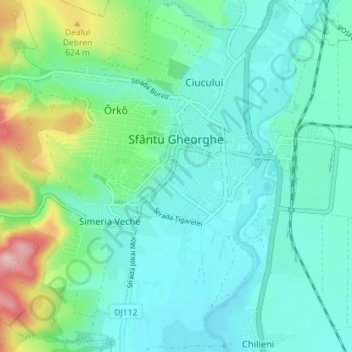
Name: Sfântu Gheorghe topographic map, elevation, terrain.
Location: Sfântu Gheorghe, Covasna, Romania (45.83592 25.75993 45.88548 25.82266)
Average elevation: 551 m
Minimum elevation: 509 m
Maximum elevation: 701 m