
勝山市 topographic map
Interactive map
Click on the map to display elevation.
About this map
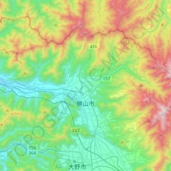
Name: 勝山市 topographic map, elevation, terrain.
Location: 勝山市, Präfektur Fukui, Chūbu, Japan (36.00698 136.38829 36.15914 136.65902)
Average elevation: 542 m
Minimum elevation: 52 m
Maximum elevation: 1,607 m
Other topographic maps
Click on a map to view its topography, its elevation and its terrain.