Geolocate

Dagatan topographic map

Click on the map to display elevation.

About this map

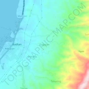
Name: Dagatan topographic map, elevation, terrain.

Location: Dagatan, Badian, Cebu, Central Visayas, 6031, Philippines (9.85003 123.39154 9.89003 123.43154)

Average elevation: 111 m

Minimum elevation: -3 m

Maximum elevation: 494 m

Gear up for your next adventure:

💧Hydration Reservoirs - Convenient water bladders for hands-free drinking on the move
🧺Ultralight Dry Bags - Organize and waterproof your gear inside your rucksack
🌄Compact Monoculars - Lightweight optics for hiking
🗺️Topographic Maps - Detailed maps showing elevation and terrain features
🚶Walking Pedometers - Simple distance tracking for casual trail walkers

As an Amazon Associate, this site earns from qualifying purchases at no extra cost to you.