Geolocate

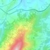
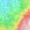
Ratoeira topographic map

Click on the map to display elevation.

About this map

Name: Ratoeira topographic map, elevation, terrain.

Location: Ratoeira, Celorico da Beira, Guarda, Portugal (40.62603 -7.37152 40.65894 -7.32944)

Average elevation: 447 m

Minimum elevation: 403 m

Maximum elevation: 554 m

Other topographic maps

Click on a map to view its topography, its elevation and its terrain.

Porteira

Portugal > Guarda > Celorico da Beira

Average elevation: 490 m

Cadafaz

Portugal > Guarda > Celorico da Beira

Average elevation: 700 m

Aldeia da Serra

Portugal > Guarda > Celorico da Beira

Average elevation: 575 m

Mogadouro

Portugal > Guarda > Celorico da Beira > Mogadouro

Average elevation: 511 m

Barco

Portugal > Guarda > Celorico da Beira

Average elevation: 438 m

Açores

Portugal > Guarda > Celorico da Beira

Average elevation: 492 m

Cortiçô da Serra

Portugal > Guarda > Celorico da Beira

Average elevation: 574 m

Penha de Prados

Portugal > Guarda > Celorico da Beira > Prados

Average elevation: 1,030 m

Linhares

Portugal > Guarda > Celorico da Beira

Average elevation: 798 m

Gear up for your next adventure:

🔦Waterproof LED Headlamps - Hands-free lighting for evening treks and emergency navigation
🧣Neck Gaiters - Protects against wind and sun on exposed ridges and peaks
🌦️Portable Weather Meters - Handheld tools for monitoring weather conditions
👖Convertible Hiking Trousers - Versatile zip-off pants for changing mountain weather conditions
🗺️Ordnance Survey Maps - Essential paper maps for hiking across the UK national parks

As an Amazon Associate, this site earns from qualifying purchases at no extra cost to you.