
Macusani topographic map
Click on the map to display elevation.
About this map
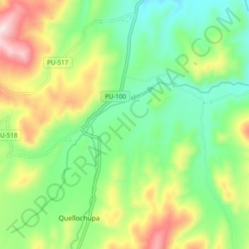
Name: Macusani topographic map, elevation, terrain.
Location: Macusani, Province of Carabaya, Puno, Peru (-14.14207 -70.46942 -14.08432 -70.40125)
Average elevation: 4,508 m
Minimum elevation: 4,335 m
Maximum elevation: 4,815 m
Other topographic maps
Click on a map to view its topography, its elevation and its terrain.