
Gurin topographic map
Interactive map
Click on the map to display elevation.
About this map
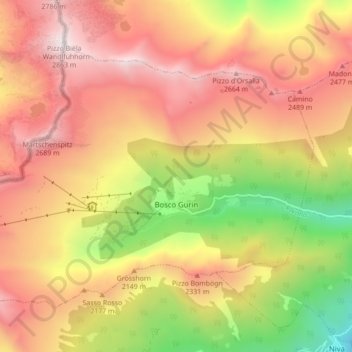
Name: Gurin topographic map, elevation, terrain.
Location: Gurin, Kreis Rovana, Bezirk Vallemaggia, Tessin, 6685, Schweiz (46.29911 8.43890 46.34402 8.52589)
Average elevation: 1,962 m
Minimum elevation: 873 m
Maximum elevation: 2,826 m