
Petros topographic map
Interactive map
Click on the map to display elevation.
About this map
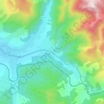
Name: Petros topographic map, elevation, terrain.
Location: Petros, Baru, Hunedoara, 337037, Romania (45.45114 23.17141 45.49114 23.21141)
Average elevation: 642 m
Minimum elevation: 472 m
Maximum elevation: 1,040 m
Other topographic maps
Click on a map to view its topography, its elevation and its terrain.
Sălașu de Sus
Romania > Hunedoara > Sălașu de Sus
Sălașu de Sus, Hunedoara, 337420, Romania
Average elevation: 491 m