
Thank you for supporting this site ❤️
Make a donation
Make a donation
Gear up for your next adventure:
As an Amazon Associate, this site earns from qualifying purchases at no extra cost to you.
Albaretto topographic map
Click on the map to display elevation.
Thank you for supporting this site ❤️
Make a donation
Make a donation
Gear up for your next adventure:
As an Amazon Associate, this site earns from qualifying purchases at no extra cost to you.
About this map
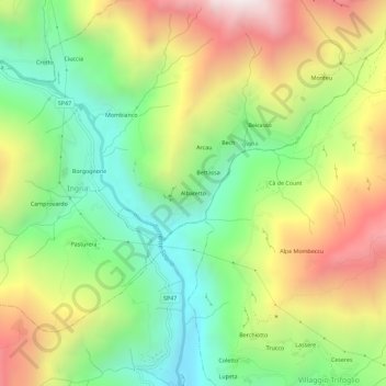
Name: Albaretto topographic map, elevation, terrain.
Location: Albaretto, Ingria, Torino, Piemonte, 10085, Italia (45.44594 7.56802 45.48594 7.60802)
Average elevation: 1,134 m
Minimum elevation: 555 m
Maximum elevation: 1,931 m
Thank you for supporting this site ❤️
Make a donation
Make a donation
Gear up for your next adventure:
As an Amazon Associate, this site earns from qualifying purchases at no extra cost to you.