
Tangle topographic map
Interactive map
Click on the map to display elevation.
About this map
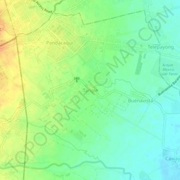
Name: Tangle topographic map, elevation, terrain.
Location: Tangle, Mexico, Pampanga, Central Luzon, Philippines (15.14756 120.63159 15.18756 120.67159)
Average elevation: 49 m
Minimum elevation: 34 m
Maximum elevation: 67 m
Other topographic maps
Click on a map to view its topography, its elevation and its terrain.
Acli
Philippines > Pampanga > Mexico
Acli, Mexico, Pampanga, Central Luzon, 1992, Philippines
Average elevation: 48 m
Mexico
Philippines > Pampanga > Mexico
Mexico, Pampanga, Central Luzon, 20, Philippines
Average elevation: 7 m
San Lorenzo
Philippines > Pampanga > Mexico > San Lorenzo
San Lorenzo, Mexico, Pampanga, Central Luzon, 2022, Philippines
Average elevation: 5 m