Geolocate

Tangle topographic map

Click on the map to display elevation.

About this map

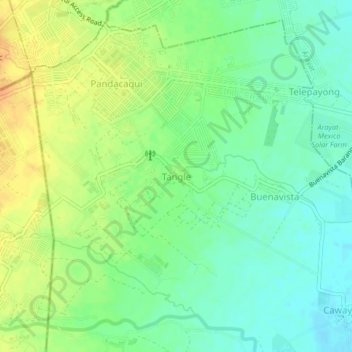
Name: Tangle topographic map, elevation, terrain.

Location: Tangle, Mexico, Pampanga, Central Luzon, Philippines (15.14756 120.63159 15.18756 120.67159)

Average elevation: 49 m

Minimum elevation: 34 m

Maximum elevation: 67 m

Gear up for your next adventure:

🔋Power Banks - Portable chargers for long outdoor trips
🧺Ultralight Dry Bags - Organize and waterproof your gear inside your rucksack
🧴Tick Removal Tools - Small, essential health tool for UK woodland and moorland
🧥Breathable Waterproof Jackets - Essential rain protection for the unpredictable British climate
🔭Compact Hiking Binoculars - Lightweight optics for scouting terrain and spotting wildlife

As an Amazon Associate, this site earns from qualifying purchases at no extra cost to you.