Geolocate

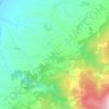
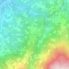
Cativelos topographic map

Click on the map to display elevation.

About this map

Name: Cativelos topographic map, elevation, terrain.

Location: Cativelos, Gouveia, Guarda, Portugal (40.52115 -7.72154 40.55975 -7.65428)

Average elevation: 374 m

Minimum elevation: 231 m

Maximum elevation: 500 m

Other topographic maps

Click on a map to view its topography, its elevation and its terrain.

Nabais

Portugal > Guarda > Gouveia

Average elevation: 599 m

Moimenta da Serra

Portugal > Guarda > Gouveia

Average elevation: 592 m

Serra do Boi

Portugal > Guarda > Gouveia

Average elevation: 1,130 m

Nespereira

Portugal > Guarda > Gouveia

Average elevation: 504 m

Melo

Portugal > Guarda > Gouveia

Average elevation: 665 m

Figueiró da Serra

Portugal > Guarda > Gouveia

Average elevation: 628 m

Vinhó

Portugal > Guarda > Gouveia

Average elevation: 528 m

Freixo da Serra

Portugal > Guarda > Gouveia

Average elevation: 659 m

Mangualde da Serra

Portugal > Guarda > Gouveia

Average elevation: 691 m

Cabeça do Faraó

Portugal > Guarda > Gouveia > Folgosinho

Average elevation: 1,173 m

Tazem

Portugal > Guarda > Gouveia > Vila Nova de Tazem

Average elevation: 442 m

Freixo da Serra

Portugal > Guarda > Gouveia

Average elevation: 659 m

Gear up for your next adventure:

🥾Walking Shoes - Lightweight walking shoes for countryside and coastal paths
🧢Thermal Beanie Hats - Prevent heat loss from the head in windy summit conditions
👟Women's Trail Running Shoes - Agile footwear for fell running and technical trails
🧥Breathable Waterproof Jackets - Essential rain protection for the unpredictable British climate
🎒Replacement Sternum Straps - Repair parts for hiking rucksacks

As an Amazon Associate, this site earns from qualifying purchases at no extra cost to you.