Geolocate

Groveton topographic map

Click on the map to display elevation.

About this map

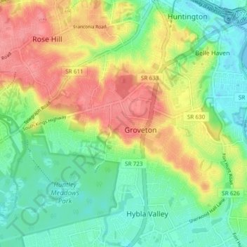
Name: Groveton topographic map, elevation, terrain.

Location: Groveton, Fairfax County, Virginia, United States (38.73994 -77.13292 38.78150 -77.05938)

Average elevation: 33 m

Minimum elevation: -2 m

Maximum elevation: 80 m

Gear up for your next adventure:

🧤Hiking Gloves - Warm and durable gloves for cold-weather walks
🛰️Outdoor GPS Navigation - Navigation devices for remote and off-grid areas
🎒Hiking Backpacks - Comfortable backpacks for day hikes and multi-day treks
👟Women's Trail Running Shoes - Agile footwear for fell running and technical trails
📱Rugged Phone Cases - Heavy-duty protection for smartphones used as secondary GPS tools

As an Amazon Associate, this site earns from qualifying purchases at no extra cost to you.