
保安藏族乡 topographic map
Interactive map
Click on the map to display elevation.
About this map
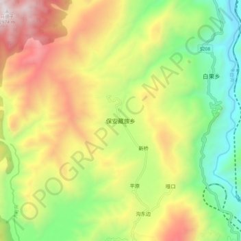
Name: 保安藏族乡 topographic map, elevation, terrain.
Location: 保安藏族乡, 越西县, 凉山彝族自治州, 四川省, 中国 (28.75745 102.51796 28.83745 102.59796)
Average elevation: 2,056 m
Minimum elevation: 1,304 m
Maximum elevation: 3,037 m
Other topographic maps
Click on a map to view its topography, its elevation and its terrain.