Geolocate

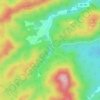
Natural Bridge topographic map

Click on the map to display elevation.

About this map

Name: Natural Bridge topographic map, elevation, terrain.

Location: Natural Bridge, Rockbridge County, Virginia, 24578, United States (37.61019 -79.56319 37.65019 -79.52319)

Average elevation: 357 m

Minimum elevation: 226 m

Maximum elevation: 446 m

Other topographic maps

Click on a map to view its topography, its elevation and its terrain.

Kerrs Creek

United States > Virginia > Rockbridge County

Average elevation: 460 m

Goshen

United States > Virginia > Rockbridge County

Average elevation: 472 m

Goshen

United States > Virginia > Rockbridge County

Average elevation: 472 m

Glasgow

United States > Virginia > Rockbridge County

Average elevation: 284 m

Glasgow

United States > Virginia > Rockbridge County

Average elevation: 284 m

Goshen

United States > Virginia > Rockbridge County

Average elevation: 472 m

Goshen Scout Reservation

United States > Virginia > Rockbridge County

The first year camper program, called Bowman Brigade, focuses on the rank requirements of Scout, Tenderfoot, Second Class, and First Class. Staff introduce participants to different merit badges. The older Scout program with an age requirement of 14, called Bowman Vets, focuses on wakeboarding, action archery,…

Average elevation: 510 m
Goshen

United States > Virginia > Rockbridge County

Average elevation: 472 m

Gear up for your next adventure:

🧣Fleece Neck Warmers - Extra insulation for winter topographic surveys
🔦Waterproof LED Headlamps - Hands-free lighting for evening treks and emergency navigation
👕Technical Hiking Tees - Moisture-management for high-exertion climbs
📸Action Camera Chest Mounts - Record your ascent following topographic paths hands-free
🕶️Polarized Sunglasses - Reduces glare from snow and water when reading terrain

As an Amazon Associate, this site earns from qualifying purchases at no extra cost to you.