Geolocate

Green Spring topographic map

Click on the map to display elevation.

About this map
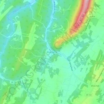
Name: Green Spring topographic map, elevation, terrain.

Location: Green Spring, Frederick County, Virginia, United States (39.28427 -78.18945 39.32427 -78.14945)

Average elevation: 245 m

Minimum elevation: 192 m

Maximum elevation: 379 m

Other topographic maps

Click on a map to view its topography, its elevation and its terrain.

Gore

United States > Virginia > Frederick County > Gore

Average elevation: 255 m

Brucetown

United States > Virginia > Frederick County > Brucetown

Average elevation: 176 m

Middletown

United States > Virginia > Frederick County

Average elevation: 211 m

Gore

United States > Virginia > Frederick County > Gore

Average elevation: 255 m

Gear up for your next adventure:

🧺Microfibre Travel Towels - Fast-drying and compact towels for wild swimming and camping
🎒Backpack Rain Covers - Universal waterproof covers to protect your gear from downpours
🔦Waterproof LED Headlamps - Hands-free lighting for evening treks and emergency navigation
📷Outdoor Action Cameras - Cameras designed for hiking and adventure
🔦LED Camping Lanterns - Illumination for reading maps inside your tent at night

As an Amazon Associate, this site earns from qualifying purchases at no extra cost to you.