
Thank you for supporting this site ❤️
Make a donation
Make a donation
Gear up for your next adventure:
As an Amazon Associate, this site earns from qualifying purchases at no extra cost to you.
Coyula topographic map
Click on the map to display elevation.
Thank you for supporting this site ❤️
Make a donation
Make a donation
Gear up for your next adventure:
As an Amazon Associate, this site earns from qualifying purchases at no extra cost to you.
About this map
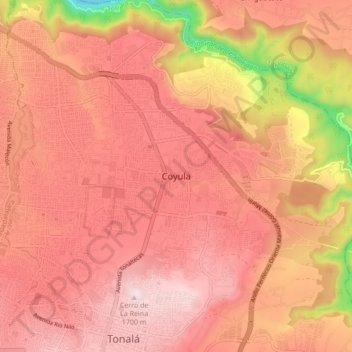
Name: Coyula topographic map, elevation, terrain.
Location: Coyula, Tonalá, Jalisco, 45406, Mexico (20.62115 -103.26929 20.70115 -103.18929)
Average elevation: 1,532 m
Minimum elevation: 1,094 m
Maximum elevation: 1,728 m
Thank you for supporting this site ❤️
Make a donation
Make a donation
Gear up for your next adventure:
As an Amazon Associate, this site earns from qualifying purchases at no extra cost to you.