Geolocate

Nava Raipur topographic map

Click on the map to display elevation.

About this map
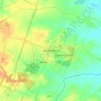
Name: Nava Raipur topographic map, elevation, terrain.

Location: Nava Raipur, Arang Tahsil, Raipur, Chhattisgarh, India (21.12103 81.74644 21.20103 81.82644)

Average elevation: 305 m

Minimum elevation: 289 m

Maximum elevation: 324 m

Other topographic maps

Click on a map to view its topography, its elevation and its terrain.

Kulhan

India > Chhattisgarh > Arang Tahsil

Average elevation: 285 m

Gear up for your next adventure:

🖼️Topographic Map Art - Decorative 3D-effect posters of famous UK peaks and regions
🔋Lithium AA Batteries - Long-lasting power that performs well in cold mountain weather
🧴Sport Sunscreen Sticks - High-protection sunblock that won't run into your eyes on the trail
🗺️Scratch-off Peak Maps - Track your progress climbing Munros or Wainwrights
🗺️Topographic Maps - Detailed maps showing elevation and terrain features

As an Amazon Associate, this site earns from qualifying purchases at no extra cost to you.