
Ninh Hải District topographic map
Interactive map
Click on the map to display elevation.
About this map
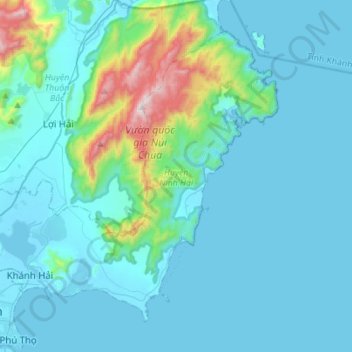
Name: Ninh Hải District topographic map, elevation, terrain.
Location: Ninh Hải District, Ninh Thuan province, Vietnam (11.56265 108.95640 11.78692 109.23353)
Average elevation: 120 m
Minimum elevation: -3 m
Maximum elevation: 1,024 m
Other topographic maps
Click on a map to view its topography, its elevation and its terrain.
Quảng trường Thành phố Phan Rang-Tháp Chàm
Vietnam > Ninh Thuan province > Phan Rang – Tháp Chàm
Average elevation: 5 m