Geolocate

Langham topographic map

Click on the map to display elevation.

About this map

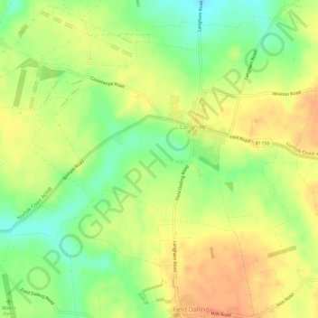
Name: Langham topographic map, elevation, terrain.

Location: Langham, North Norfolk, Norfolk, England, United Kingdom (52.91108 0.95625 52.94461 1.01279)

Average elevation: 35 m

Minimum elevation: 11 m

Maximum elevation: 54 m

Norfolk trails, hiking, mountain biking, running and outdoor activities

Gear up for your next adventure:

🎒Hiking Daypacks (20L) - Compact backpacks for day trips and technical mountain ascents
🕶️Polarized Sunglasses - Reduces glare from snow and water when reading terrain
🪢Paracord - Multi-purpose cord for camping and survival
🥾Hiking Boot Waterproofing Wax - Maintain the lifespan of your leather trekking boots
👟Women's Trail Running Shoes - Agile footwear for fell running and technical trails

As an Amazon Associate, this site earns from qualifying purchases at no extra cost to you.