Geolocate

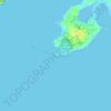
Riverview topographic map

Click on the map to display elevation.

About this map

Name: Riverview topographic map, elevation, terrain.

Location: Riverview, Gloucester, Essex County, Massachusetts, 01930, United States (42.61204 -70.70143 42.65204 -70.66143)

Average elevation: 14 m

Minimum elevation: -4 m

Maximum elevation: 53 m

Other topographic maps

Click on a map to view its topography, its elevation and its terrain.
Gear up for your next adventure:

🔥Emergency Fire Starters - Reliable ignition tools for survival situations in damp conditions
👖Hiking Trousers - Durable trousers designed for rough terrain
🎒Hiking Daypacks (20L) - Compact backpacks for day trips and technical mountain ascents
📦Dry Bags - Waterproof bags to protect gear from rain
🗺️Topographic Maps - Detailed maps showing elevation and terrain features

As an Amazon Associate, this site earns from qualifying purchases at no extra cost to you.