
Caldecott topographic map
Click on the map to display elevation.
About this map
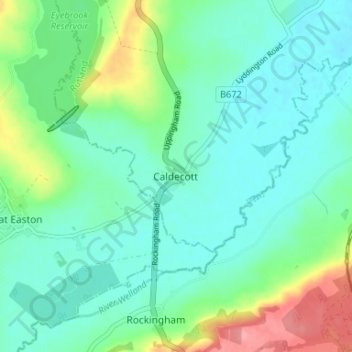
Name: Caldecott topographic map, elevation, terrain.
Location: Caldecott, Rutland, England, LE16 8RN, United Kingdom (52.51342 -0.74105 52.55342 -0.70105)
Average elevation: 66 m
Minimum elevation: 42 m
Maximum elevation: 134 m
Rutland trails, hiking, mountain biking, running and outdoor activities