Geolocate

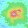
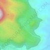
Sharp Peak topographic map

Click on the map to display elevation.

About this map

Name: Sharp Peak topographic map, elevation, terrain.

Location: Sharp Peak, Sorsogon, Bicol Region, Philippines (12.78001 124.07311 12.78011 124.07321)

Average elevation: 810 m

Minimum elevation: 399 m

Maximum elevation: 1,393 m

Other topographic maps

Click on a map to view its topography, its elevation and its terrain.
Calintaan Island

Philippines > Sorsogon > Calintaan

Average elevation: 6 m

Pilar

Philippines > Sorsogon

Average elevation: 24 m

Castilla

Philippines > Sorsogon

Average elevation: 83 m

Donsol

Philippines > Sorsogon

Average elevation: 20 m

Bulusan Lake

Philippines > Sorsogon > San Roque

Lake Bulusan is a lake on Luzon Island in the Philippines. It lies at the heart of Bulusan Volcano National Park which covers a land area of 3,672 hectares (9,070 acres). It has an elevation of 360 metres (1,180 ft) and is located on the southeast flank of Mount Bulusan, an active volcano.

Average elevation: 382 m

Sorsogon River

Philippines > Sorsogon > Sorsogon City

Average elevation: 19 m

Castilla

Philippines > Sorsogon

Average elevation: 83 m

J.Gerona (Biton)

Philippines > Sorsogon

Average elevation: 12 m

Castilla

Philippines > Sorsogon

Average elevation: 83 m

Donsol

Philippines > Sorsogon

Average elevation: 20 m

Donsol

Philippines > Sorsogon

Average elevation: 20 m

Gear up for your next adventure:

🥾Hiking Boots - Waterproof and durable boots for long-distance hiking in the UK
📍Handheld GPS Navigators - Reliable satellite navigation for hiking and off-road exploration
🦟Anti-Midge & Tick Repellent - Vital for hiking in the Scottish Highlands during summer
🧣Neck Gaiters - Versatile protection against wind and cold
🔪Outdoor Multi-Tools - Versatile tools for gear repairs and food prep in the wild

As an Amazon Associate, this site earns from qualifying purchases at no extra cost to you.