

Sullurpeta topographic map
Click on the map to display elevation.
Sullurpeta
Sullurupeta is located about 77 km east of Tirupati, 90 km south of Nellore and about 83 km north of Chennai, Tamilnadu. It is 16 km west of the world-famous ISRO island Sriharikota, where the Indian rockets are launched. The Pulicat lake separates Sullurupeta and Sriharikota. It has an average elevation of 11 meters (36 feet).
About this map
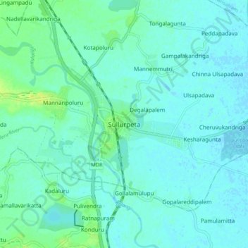
Name: Sullurpeta topographic map, elevation, terrain.
Location: Sullurpeta, Tirupati, Andhra Pradesh, 524121, India (13.66129 79.98070 13.74129 80.06070)
Average elevation: 4 m
Minimum elevation: -2 m
Maximum elevation: 15 m