
Barkam topographic map
Interactive map
Click on the map to display elevation.
About this map
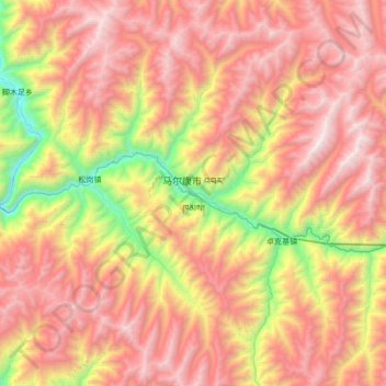
Name: Barkam topographic map, elevation, terrain.
Average elevation: 3,732 m
Minimum elevation: 2,386 m
Maximum elevation: 4,825 m
Due to its elevation, Barkam lies in the transition between a subtropical highland climate (Köppen Cwb) and humid continental climate (Köppen Dwb), with strong monsoonal influences; winters are frosty and summers warm with frequent rain. The monthly 24-hour average temperature ranges from −0.5 °C (31.1 °F) in December and January to 16.4 °C (61.5 °F) in July, while the annual mean is 8.75 °C (47.7 °F). Nearly two-thirds of the annual precipitation of 784 mm (30.9 in) occurs from June to September. With monthly percent possible sunshine ranging from 36% in June to 65% in December, the town receives 2,133 hours of bright sunshine annually. Diurnal temperature variation is large, averaging 16.0 °C (28.8 °F) annually.