
Thank you for supporting this site ❤️
Make a donation
Make a donation
Gear up for your next adventure:
As an Amazon Associate, this site earns from qualifying purchases at no extra cost to you.
Xaltipa topographic map
Click on the map to display elevation.
Thank you for supporting this site ❤️
Make a donation
Make a donation
Gear up for your next adventure:
As an Amazon Associate, this site earns from qualifying purchases at no extra cost to you.
About this map
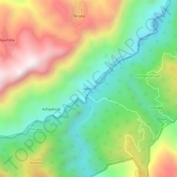
Name: Xaltipa topographic map, elevation, terrain.
Location: Xaltipa, Ilamatlán, Veracruz, México (20.69649 -98.47992 20.73649 -98.43992)
Average elevation: 915 m
Minimum elevation: 481 m
Maximum elevation: 1,541 m
Thank you for supporting this site ❤️
Make a donation
Make a donation
Gear up for your next adventure:
As an Amazon Associate, this site earns from qualifying purchases at no extra cost to you.