Geolocate

Box topographic map

Click on the map to display elevation.

About this map

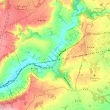
Name: Box topographic map, elevation, terrain.

Location: Box, Wiltshire, England, United Kingdom (51.39694 -2.29535 51.44542 -2.20420)

Average elevation: 113 m

Minimum elevation: 23 m

Maximum elevation: 207 m

Wiltshire trails, hiking, mountain biking, running and outdoor activities

Gear up for your next adventure:

📦Compression Sacks - Reduce backpack volume efficiently
🧥Packable Down Jackets - Lightweight warmth that compresses small in your bag
🎒Backpack Rain Covers - Universal waterproof covers to protect your gear from downpours
🕶️Polarized Sunglasses - Reduces glare from snow and water when reading terrain
🎒Hiking Backpacks - Comfortable backpacks for day hikes and multi-day treks

As an Amazon Associate, this site earns from qualifying purchases at no extra cost to you.