
Thank you for supporting this site ❤️
Make a donation
Make a donation
Gear up for your next adventure:
As an Amazon Associate, this site earns from qualifying purchases at no extra cost to you.
Calvera topographic map
Click on the map to display elevation.
Thank you for supporting this site ❤️
Make a donation
Make a donation
Gear up for your next adventure:
As an Amazon Associate, this site earns from qualifying purchases at no extra cost to you.
About this map
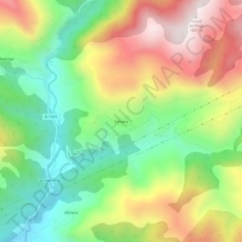
Name: Calvera topographic map, elevation, terrain.
Location: Calvera, Beranuy, Ribagorza, Huesca, Aragón, España (42.36800 0.59314 42.40800 0.63314)
Average elevation: 1,292 m
Minimum elevation: 920 m
Maximum elevation: 1,782 m
Thank you for supporting this site ❤️
Make a donation
Make a donation
Gear up for your next adventure:
As an Amazon Associate, this site earns from qualifying purchases at no extra cost to you.