Geolocate

Quellón topographic map

Click on the map to display elevation.

About this map
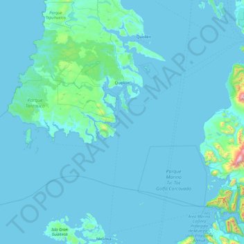
Name: Quellón topographic map, elevation, terrain.

Location: Quellón, Provincia de Chiloé, Los Lagos Region, Chile (-43.81156 -74.84802 -42.82110 -73.17441)

Average elevation: 58 m

Minimum elevation: 0 m

Maximum elevation: 2,016 m

Other topographic maps

Click on a map to view its topography, its elevation and its terrain.

Linao

Chile > Los Lagos Region > Provincia de Chiloé > Ancud

Average elevation: 22 m

Gear up for your next adventure:

👖Hiking Trousers - Durable trousers designed for rough terrain
📕Outdoor Navigation Books - Learn traditional and modern navigation techniques
🧢Waterproof Hiking Hats - Keep the rain off your face while studying topographic maps
📷Camera Straps - Secure straps for carrying cameras while walking
🧴Tick Removal Tools - Small, essential health tool for UK woodland and moorland

As an Amazon Associate, this site earns from qualifying purchases at no extra cost to you.