
Metlili topographic map
Interactive map
Click on the map to display elevation.
About this map
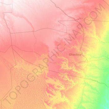
Name: Metlili topographic map, elevation, terrain.
Location: Metlili, Metlili Châamba District, Ghardaia, Algeria (32.03584 2.23994 32.83983 4.46562)
Average elevation: 529 m
Minimum elevation: 202 m
Maximum elevation: 897 m
Metlili lies at an elevation of about 500 metres (1,600 ft) in a valley running from northwest to southeast between arid, rocky hills. The town is about 12 kilometres (7.5 mi) from end to end, but only about 0.5 kilometres (0.31 mi) wide.
Other topographic maps
Click on a map to view its topography, its elevation and its terrain.