
Vikhren topographic map
Interactive map
Click on the map to display elevation.
About this map
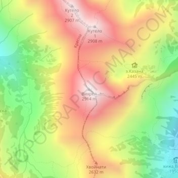
Name: Vikhren topographic map, elevation, terrain.
Average elevation: 2,442 m
Minimum elevation: 1,940 m
Maximum elevation: 2,908 m
Other topographic maps
Click on a map to view its topography, its elevation and its terrain.
Dobarsko
Bulgarie > Oblast de Blagoevgrad
Dobarsko, Municipalité de Razlog, Oblast de Blagoevgrad, 2799, Bulgarie
Average elevation: 1,100 m
Goreme
Bulgarie > Oblast de Blagoevgrad
Goreme, Municipalité de Stroumyani, Oblast de Blagoevgrad, 2834, Bulgarie
Average elevation: 740 m
Bansko
Bulgarie > Oblast de Blagoevgrad
Bansko, Municipalité de Bansko, Oblast de Blagoevgrad, 2770, Bulgarie
Average elevation: 1,034 m