
Make a donation
Gear up for your next adventure:
As an Amazon Associate, this site earns from qualifying purchases at no extra cost to you.
Daşoguz topographic map
Click on the map to display elevation.
Make a donation
Gear up for your next adventure:
As an Amazon Associate, this site earns from qualifying purchases at no extra cost to you.
About this map
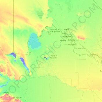
Name: Daşoguz topographic map, elevation, terrain.
Location: Daşoguz, Turkmenistan (38.78621 55.95860 43.98621 61.15860)
Average elevation: 114 m
Minimum elevation: -36 m
Maximum elevation: 967 m
Make a donation
Gear up for your next adventure:
As an Amazon Associate, this site earns from qualifying purchases at no extra cost to you.
Other topographic maps
Click on a map to view its topography, its elevation and its terrain.
Make a donation
Gear up for your next adventure:
As an Amazon Associate, this site earns from qualifying purchases at no extra cost to you.
Saparmyrat Turkmenbaşy şaherçesi
Turkmenistan > Mary Region > Saparmyrat Turkmenbaşy şaherçesi
Average elevation: 221 m
Ashgabat City
Ashgabat is very close to the border with Iran. It occupies a highly seismically active oasis plain bounded on the south by the foothills of the Kopet Dag mountains (Turkmen: Köpetdag) and on the north by the Karakum Desert. It is surrounded by, but not part of, Ahal Province (Turkmen: Ahal welaýaty). The…
Average elevation: 467 m
Make a donation
Gear up for your next adventure:
As an Amazon Associate, this site earns from qualifying purchases at no extra cost to you.