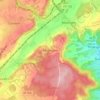
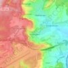
Contern topographic map
Click on the map to display elevation.
Contern
Contern lies within the Guttland region of Luxembourg and covers part of both the Luxembourg Plateau and Moselle Valley sub-regions. The contrast between the two sub regions gives Contern a varying topography, from the rolling hills in the south and west to the sharp sandstone cliffs to the east around Medingen and the north around Kréintgeshaff and Éiterbierg.
About this map

Name: Contern topographic map, elevation, terrain.
Location: Contern, Canton Luxembourg, Luxembourg (49.56757 6.19542 49.61011 6.30285)
Average elevation: 307 m
Minimum elevation: 194 m
Maximum elevation: 377 m
Other topographic maps
Click on a map to view its topography, its elevation and its terrain.
Luxembourg City: Old Quarters & Fortifications
Luxembourg > Canton Luxembourg > Luxembourg
Average elevation: 294 m