
Thank you for supporting this site ❤️
Make a donation
Make a donation
Gear up for your next adventure:
As an Amazon Associate, this site earns from qualifying purchases at no extra cost to you.
Cholula topographic map
Click on the map to display elevation.
Thank you for supporting this site ❤️
Make a donation
Make a donation
Gear up for your next adventure:
As an Amazon Associate, this site earns from qualifying purchases at no extra cost to you.
About this map
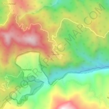
Name: Cholula topographic map, elevation, terrain.
Location: Cholula, Tianguistengo, Hidalgo, Mexico (20.72333 -98.52222 20.76333 -98.48222)
Average elevation: 1,266 m
Minimum elevation: 842 m
Maximum elevation: 1,759 m
Thank you for supporting this site ❤️
Make a donation
Make a donation
Gear up for your next adventure:
As an Amazon Associate, this site earns from qualifying purchases at no extra cost to you.