
Terrell topographic map
Click on the map to display elevation.
About this map
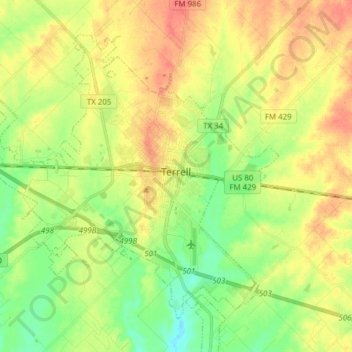
Name: Terrell topographic map, elevation, terrain.
Location: Terrell, Kaufman County, Texas, United States (32.68195 -96.37502 32.78676 -96.22128)
Average elevation: 153 m
Minimum elevation: 127 m
Maximum elevation: 180 m
Other topographic maps
Click on a map to view its topography, its elevation and its terrain.