Geolocate

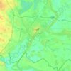
Zemplén Mountains topographic map

Click on the map to display elevation.

Zemplén Mountains

Zemplén Mountains (Hungarian: [ˈzɛmpleːn]) or Tokaj Mountains (Hungarian: [ˈtokɒj]; Hungarian: Zempléni-hegység or Tokaji-hegység) is a mountain range in Hungary. The Zemplén Mountains form part of the Tokaj-Eperjes mountain chain in Hungary, known for their ecological richness and historical significance. Geographically diverse, the region contains distinct landscape areas including peripheral lowlands and isolated higher-altitude interior zones, many of which are protected as part of the Zemplén Landscape Protection Area. The mountains support considerable biodiversity, with recent studies highlighting a significant diversity of flora, mammals such as wolves, lynxes, and rare bat species, as well as unique fish communities including the Carpathian barbel and Carpathian brook lamprey. Historically, the mountains hosted several medieval Pauline monasteries, reflecting the area's longstanding cultural importance. While traditionally dependent on agriculture and forestry, the local economy now increasingly emphasises sustainable tourism, leveraging both the natural and cultural heritage of the region.

Wikipedia (CC-BY-SA 3.0)

About this map

Name: Zemplén Mountains topographic map, elevation, terrain.

Location: Zemplén Mountains, Great Plain and North, Hungary (48.10356 21.18215 48.58457 21.65171)

Average elevation: 206 m

Minimum elevation: 89 m

Maximum elevation: 884 m

Other topographic maps

Click on a map to view its topography, its elevation and its terrain.
Budapest

Hungary

The wide Danube was always fordable at this point because of a small number of islands in the middle of the river. The city has marked topographical contrasts: Buda is built on the higher river terraces and hills of the western side, while the considerably larger Pest spreads out on a flat and featureless sand…

Average elevation: 153 m
Lake Balaton

Hungary > Veszprém

Average elevation: 191 m

Kecskemét

Hungary > Bács-Kiskun

Kecskemét was established at the meeting point of a large sandy region and a sandy yellow soil. Its elevation is 120 m (394 ft) above sea level. The territory west of the city is covered by wind-blown sand and is characterised by the almost parallel northern-southern sand dunes and the plain between them. In…

Average elevation: 116 m

Budapest

Hungary

The wide Danube was always fordable at this point because of a small number of islands in the middle of the river. The city has marked topographical contrasts: Buda is built on the higher river terraces and hills of the western side, while the considerably larger Pest spreads out on a flat and featureless sand…

Average elevation: 153 m

Csikóstőttős

Hungary > Tolna

Average elevation: 132 m

Szilvásvárad

Hungary > Heves

Average elevation: 465 m

Csömör

Hungary > Pest

Average elevation: 195 m

Zabar

Hungary > Nógrád

Average elevation: 278 m

9339

Hungary > Győr-Moson-Sopron > Kapuvár

Average elevation: 116 m

Moha

Hungary > Fejér

Average elevation: 124 m

Pécs

Hungary > Baranya

Pécs is bordered by plains to the south (elevation 120–130 m), while the Mecsek mountains rise up to elevations of 400–600 meters behind the city. Jakab-hill, located in the western Mecsek, is 592 m (1942 ft) tall, Tubes, straight above Pécs, is 612 m (2008 ft) tall, and Misina is 535 m (1755 ft) tall.…

Average elevation: 232 m

8th district

Hungary > Budapest

Average elevation: 115 m

Fazekasboda

Hungary > Baranya

Average elevation: 203 m

Felsőnyáregyháza

Hungary > Pest > Nyáregyháza

Average elevation: 137 m

Budapest

Hungary

The wide Danube was always fordable at this point because of a small number of islands in the middle of the river. The city has marked topographical contrasts: Buda is built on the higher river terraces and hills of the western side, while the considerably larger Pest spreads out on a flat and featureless sand…

Average elevation: 171 m

Szeged

Hungary > Csongrád-Csanád County > Szeged

Average elevation: 82 m

Raab

Hungary

Average elevation: 311 m

Tisza

Hungary

The 1800–2500 m high ridge of the Carpathian Mountains create in a semi circle the northern, eastern and southeastern boundary of the Tisza catchment. The western - southwestern reach of the watershed is comparatively low in some places – on its Hungarian and Serbian parts it is almost flat. The area is…

Average elevation: 232 m

Pannonian Basin

Hungary > Pest > Cegléd

Pannonian basin vs Carpathian basin: On the territory of present-day Hungary the ancient Roman Pannonia province was located only on Transdanubian territories, however the Great Hungarian Plain was not part of Pannonia province. This comprises less than 29% of modern Hungary, therefore Hungarian geographers…

Average elevation: 99 m

Örkény

Hungary > Pest

Average elevation: 125 m

13th district

Hungary > Budapest

Average elevation: 110 m

Bálványos

Hungary > Somogy

Average elevation: 221 m

Pécs

Hungary > Baranya

Pécs is bordered by plains to the south (elevation 120–130 m), while the Mecsek mountains rise up to elevations of 400–600 meters behind the city. Jakab-hill, located in the western Mecsek, is 592 m (1942 ft) tall, Tubes, straight above Pécs, is 612 m (2008 ft) tall, and Misina is 535 m (1755 ft) tall.…

Average elevation: 232 m

Budapest

Hungary

The wide Danube was always fordable at this point because of a small number of islands in the middle of the river. The city has marked topographical contrasts: Buda is built on the higher river terraces and hills of the western side, while the considerably larger Pest spreads out on a flat and featureless sand…

Average elevation: 171 m

Csobánka

Hungary > Pest

Average elevation: 249 m

Pat

Hungary > Zala

Average elevation: 137 m

Üllő

Hungary > Pest

Average elevation: 128 m

Debrecen

Hungary > Hajdú-Bihar

Average elevation: 120 m

Budapest

Hungary

The wide Danube was always fordable at this point because of a small number of islands in the middle of the river. The city has marked topographical contrasts: Buda is built on the higher river terraces and hills of the western side, while the considerably larger Pest spreads out on a flat and featureless sand…

Average elevation: 153 m

Budapest

Hungary

The wide Danube was always fordable at this point because of a small number of islands in the middle of the river. The city has marked topographical contrasts: Buda is built on the higher river terraces and hills of the western side, while the considerably larger Pest spreads out on a flat and featureless sand…

Average elevation: 171 m

Kis-Sváb-hegy

Hungary > Budapest

Average elevation: 195 m

Szeged

Hungary > Csongrád-Csanád

Average elevation: 80 m

Zsámbék

Hungary > Pest

Average elevation: 189 m

Kaposmérő

Hungary > Somogy

Average elevation: 161 m

Szentendre

Hungary > Pest

Average elevation: 169 m

Salgótarján

Hungary > Nógrád

Average elevation: 331 m

Sopron

Hungary > Győr-Moson-Sopron

Average elevation: 216 m

Nagykovácsi

Hungary > Pest

Average elevation: 385 m

Sopron

Hungary > Győr-Moson-Sopron

Average elevation: 216 m

Debrecen

Hungary > Hajdú-Bihar

Average elevation: 120 m

Tisza

Hungary

The 1800–2500 m high ridge of the Carpathian Mountains create in a semi circle the northern, eastern and southeastern boundary of the Tisza catchment. The western - southwestern reach of the watershed is comparatively low in some places – on its Hungarian and Serbian parts it is almost flat. The area is…

Average elevation: 232 m

Budapest

Hungary

The wide Danube was always fordable at this point because of a small number of islands in the middle of the river. The city has marked topographical contrasts: Buda is built on the higher river terraces and hills of the western side, while the considerably larger Pest spreads out on a flat and featureless sand…

Average elevation: 171 m

Somogy

Hungary

Average elevation: 163 m

Bonyhád

Hungary > Tolna

Average elevation: 145 m

Gárdony

Hungary > Fejér

Average elevation: 125 m

Győr-Moson-Sopron

Hungary

Average elevation: 158 m

Marcali

Hungary > Somogy

Average elevation: 151 m

Somogy

Hungary

Average elevation: 163 m

Monor

Hungary > Pest

Average elevation: 149 m

Bogács

Hungary > Borsod-Abaúj-Zemplén

Average elevation: 201 m

Hajdú-Bihar

Hungary

Average elevation: 110 m

Szada

Hungary > Pest

Average elevation: 224 m

Tolna

Hungary

Average elevation: 151 m

Pécs

Hungary > Baranya > Pécs

Pécs is bordered by plains to the south (elevation 120–130 m), while the Mecsek mountains rise up to elevations of 400–600 meters behind the city. Jakab-hill, located in the western Mecsek, is 592 m (1942 ft) tall, Tubes, straight above Pécs, is 612 m (2008 ft) tall, and Misina is 535 m (1755 ft) tall.…

Average elevation: 210 m

Miskolc

Hungary > Borsod-Abaúj-Zemplén > Miskolc

Average elevation: 206 m

Szombathely

Hungary > Vas

Average elevation: 220 m

Csertő

Hungary > Baranya

Average elevation: 141 m

3517

Hungary > Borsod-Abaúj-Zemplén > Miskolc

Average elevation: 544 m

Gyor

Hungary > Győr-Moson-Sopron

Average elevation: 120 m

1075

Hungary > Budapest

Average elevation: 118 m

Páty

Hungary > Pest

Average elevation: 247 m

Neszmély

Hungary > Komárom-Esztergom

Average elevation: 198 m

9th district

Hungary > Budapest

Average elevation: 112 m

Bokod

Hungary > Komárom-Esztergom

Average elevation: 210 m

Miskolc

Hungary > Borsod-Abaúj-Zemplén

The lowest areas are the banks of the river Sajó, with an altitude of 110–120 m (360–390 ft). The area belongs to the Great Plain region and is made up of sedimentary rocks. Between the Avas hill and Diósgyőr lies the hilly area of the Lower Bükk (250–300 m or 820–980 ft) consisting of sandstone,…

Average elevation: 194 m

Geresdlak

Hungary > Baranya

Average elevation: 199 m
Tolna

Hungary

Average elevation: 151 m

Kecel

Hungary > Bács-Kiskun

Average elevation: 104 m

Kaposvár

Hungary > Somogy

Average elevation: 162 m

Tiszavalki-medence

Hungary > Heves > Poroszló

Average elevation: 87 m

Keszthely

Hungary > Zala

Average elevation: 155 m

Péterhegy

Hungary > Veszprém > Csopak

Average elevation: 169 m

Geresdlak

Hungary > Baranya

Average elevation: 199 m
Zala

Hungary

Average elevation: 182 m

Lenti

Hungary > Zala

Average elevation: 187 m

Barcs

Hungary > Somogy

Average elevation: 118 m

Vas

Hungary

Average elevation: 217 m

Baranya

Hungary

Average elevation: 147 m

Csókakő

Hungary > Fejér

Average elevation: 297 m

Felcsút

Hungary > Fejér

Average elevation: 167 m

Veszprém

Hungary > Veszprém

Average elevation: 297 m

Tihany

Hungary > Veszprém

Average elevation: 112 m

Zebegény

Hungary > Pest

Average elevation: 179 m

Zala

Hungary

Average elevation: 182 m

Szabolcs-Szatmár-Bereg

Hungary

Average elevation: 139 m

Heves

Hungary

Average elevation: 203 m

Békés

Hungary

Average elevation: 90 m

Deseda

Hungary > Somogy > Kaposvár

Average elevation: 155 m

Érd

Hungary > Pest

Average elevation: 138 m

Esztergom

Hungary > Komárom-Esztergom

Average elevation: 188 m

Újfalu

Hungary > Baranya > Kozármisleny

Average elevation: 174 m

Baktüttös

Hungary > Zala

Average elevation: 199 m

Sándorfalva

Hungary > Csongrád-Csanád

Average elevation: 81 m

2653

Hungary > Nógrád > Bánk

Average elevation: 216 m

9675

Hungary > Vas > Bögöte

Average elevation: 161 m

Ura

Hungary > Szabolcs-Szatmár-Bereg

Average elevation: 115 m

Gear up for your next adventure:

🧥Packable Down Jackets - Lightweight warmth that compresses small in your bag
📢Survival Whistles - Essential safety gear for signaling for help in mountain fog
🎒Backpack Rain Covers - Universal waterproof covers to protect your gear from downpours
🔦Outdoor Torches - Reliable torches for night navigation
👖Packable Overtrousers - Quick-deploy rain protection for legs in sudden storms

As an Amazon Associate, this site earns from qualifying purchases at no extra cost to you.