Geolocate

Tingés topographic map

Click on the map to display elevation.

About this map

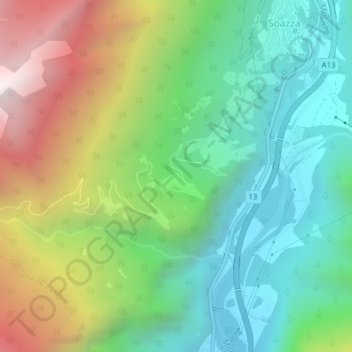
Name: Tingés topographic map, elevation, terrain.

Location: Tingés, Soazza, Moësa, Grisons, 6562, Switzerland (46.34438 9.19966 46.36438 9.21966)

Average elevation: 1,044 m

Minimum elevation: 470 m

Maximum elevation: 2,100 m

Gear up for your next adventure:

🔦Head Torches - Hands-free lighting for hiking and camping
🧢Waterproof Hiking Hats - Keep the rain off your face while studying topographic maps
🛌Sleeping Mats - Insulated mats for comfortable outdoor sleeping
🚲Bikepacking Frame Bags - Storage for tools and navigation gear on long off-road rides
🔦Keychain LED Torches - Emergency backup light for finding gear in your pack

As an Amazon Associate, this site earns from qualifying purchases at no extra cost to you.