Geolocate

Stony Stratford topographic map

Interactive map

Click on the map to display elevation.

About this map

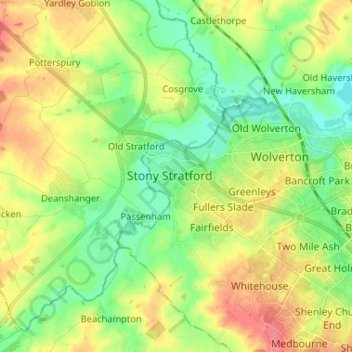
Name: Stony Stratford topographic map, elevation, terrain.

Location: Stony Stratford, Milton Keynes, South East England, England, MK11 1LG, United Kingdom (52.01657 -0.89010 52.09657 -0.81010)

Average elevation: 83 m

Minimum elevation: 56 m

Maximum elevation: 121 m

Other topographic maps

Click on a map to view its topography, its elevation and its terrain.

Upper Weald

United Kingdom > England > Stony Stratford > Upper Weald > Upper Weald

Upper Weald, Calverton, Stony Stratford, Milton Keynes, South East England, England, MK19 6EL, United Kingdom

Average elevation: 90 m

Ouse Valley Park

United Kingdom > England > Stony Stratford

Ouse Valley Park, Wolverton and Greenleys, Stony Stratford, Milton Keynes, South East, England, United Kingdom

Average elevation: 75 m