
Thank you for supporting this site ❤️
Make a donation
Make a donation
Gear up for your next adventure:
As an Amazon Associate, this site earns from qualifying purchases at no extra cost to you.
Coelemu topographic map
Click on the map to display elevation.
Thank you for supporting this site ❤️
Make a donation
Make a donation
Gear up for your next adventure:
As an Amazon Associate, this site earns from qualifying purchases at no extra cost to you.
About this map
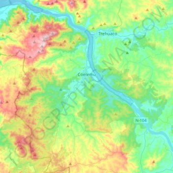
Name: Coelemu topographic map, elevation, terrain.
Location: Coelemu, Provincia de Itata, Nuble Region, 3970000, Chile (-36.62542 -72.88490 -36.38396 -72.60616)
Average elevation: 166 m
Minimum elevation: 0 m
Maximum elevation: 539 m
Thank you for supporting this site ❤️
Make a donation
Make a donation
Gear up for your next adventure:
As an Amazon Associate, this site earns from qualifying purchases at no extra cost to you.