
East Moline topographic map
Interactive map
Click on the map to display elevation.
About this map
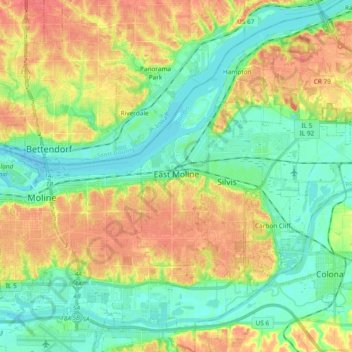
Name: East Moline topographic map, elevation, terrain.
Location: East Moline, Rock Island County, Illinois, United States (41.47866 -90.46296 41.55043 -90.27577)
Average elevation: 191 m
Minimum elevation: 168 m
Maximum elevation: 225 m